Sunday, May 17, 2009

Llanddwyn: Another little gap


We have walked along Llanddwyn Beach before but not, it seems, since starting this project.

On Sunday May 10, we started at the roundabout by Newborough, the one with the marram grass sculptures in the car park where we had also started out for Abermenai and Aber Braint. A camera-shy Great Spotted Woodpecker kept us company on the way down to the beach. Turning right, we continued along a busy beach until reaching the path towards Malltraeth, before Ynys Llanddwyn. Here we doubled back along the trail through the woods which is actually marked as the Coastal Path, then back to our starting point.

Saturday, August 16, 2008

Filling in another small gap, and some new leaflets

On Friday 8 August we sought to fill in small gap in our coverage of the Coastal Path, between Porth Trecastell (Cable Bay) and Porth Cwyfan. When we started out on doing the coastal path, this little bit wasn't necessarily part of it, and it's not shown in our 2005 edition of the OS Explorer 262 map, either. The "at the time of writing" in the Official Guide seemed a little tentative, too.

Still, we needn't have worrried as the path was clear enough on the ground. A little sign says it's permissive path, which means (in this case) you can use it any time but the 10th of December each year.

Having walked round over the headland from Porth Trecastell as far as Llangwyfan-isaf, we tried to make a circular walk of it by returning first along the road past Plas Llangwyfan, then crossing the A4080 towards the small church of St. Mary's Llangwyfan. We found that the first footpath to the left indicated on the Explorer 262 wasn't there, or at least didn't have an entry from the road, so we proceeded to the next one, just after the church. This brought us back via farmhouses Rhosmor and Cnwc, towards Porth Trecastell. We also found that the path down to the beach isn't the straight line suggested by Explorer 262: it is necessary to turn sharp left to leave the rocky crag to your right before proceeding along a track at the base of this sandy valley.

A number of Stonechats seen on this walk.

We have also come across some new leaflets of circular walks - available here as pdfs or by post from here. We've covered many of these walks, or bits of them, already. First impressions of these leaflets not very good - walkers like us need to know the length and difficulty stright off, which unlike many of our guidebooks, these don't give.

Saturday, May 24, 2008

Cemlyn - Cemaes


Today, 24 May, was the first day of the 2008 Anglesey Walking Festival, but that wasn't why we went for a walk - just that we had the time and weather forecast seemed much worse for the rest of the Bank Holiday weekend. The weather today turned out ideal: blue skies, sunny and dry but a stiff easterly breeze all the way.

This was a long walk by our standards, combining, roughly Rogers Volume 2 walk 7 and walk 8, making a total of nine miles.

We started, in fact, at the eastern end of the bar at Cemlyn, and the walk along the shingle bar was not at all comfortable, so we came round the shoreward side of the lagoon before pressing on towards Cemaes.

This section is of couse rather marred by the huge Wylfa Power Station plonked on the coast. Having passed it, we took in the inland path of walk 7 to get to the village of Cemaes. Here we stopped at the Stag Inn. We were warned as we arrived that service could be slow which indeed it was, but the beer was good (Jennings Bitter) and the food reasonable. We took the Coastal Path proper round Wylfa Head, which was the wildest and windiest part of the walk: choughs here as well as the more common seabirds.
We were very glad after returning to Cemlyn to be able to stop at the nearby jam factory for tea and cake!

Aberffraw - Malltraeth


On 18 May we started from Aberffraw village and walked down the estuary following the beach option of the Coastal Path. Going inland later through the dunes, we surprised a hare - and it very obviously was a hare, too, as we were to remark later when we saw the more common rabbits.


The Coastal Path isn't particularly coastal for the next bit, as it passes along the A4080 through Hebron, but on reaching the brow of the hill there is a splendid view of Snowdonia.
We crossed the cob at Malltraeth to join up with where we had reached on an earlier walk to Llanddwyn - while watching the cattle wading through the lagoon.

Monday, December 31, 2007

Progress (2) and a new book


Here's what we've covered (in blue) up to the end of 2007. Maybe there's a chance of completing it all in 2008!
In addition to the books we have been using and referred to earlier (see references), there's another book out about the Coastal Path - All Around Anglesey by Terry Beggs (ISBN 978 184323 715 0). It's a coffee-table book with pictures around the path, not a guide book.

Porth Llechog - Porth Amlwch


Our little walk today took us from Porth Llechog (Bull Bay) to Porth Amlwch (Amlwch Port), and back.
The path here is mostly at the top of jagged cliffs characteristic of much of North Anglesey. It was surprisingly muddy and the day rather gloomy, so much so that after reaching Amlwch we decided to return along the road.

Thursday, December 27, 2007

Stanley Embankment and Valley


Our Boxing Day outing didn't follow any of the handy little circular walks in our guidebooks, and wasn't as well-signposted as usual, so I'll have to be more careful in describing the route.

We started at the Penrhos Coastal Park and began the walk towards mainland Anglesey along the Stanley Embankment. At the mainland end, just by the ATS Euromaster tyre depot, a Coastal Path finger sign pointed northwards along the shore and, as high tide had passed, we followed the shoreline. This was a rocky and pebbly beach, starting off with the eclectic boulder clay pebbles we have seen so often around the path. As we progressed, the beach became dominated more by the local rock, with varied hues of red, purple and pink of the 'New Harbour series'.

Just before a small headland, we avoided a path inland to the right with the remains of a signpost but pressed on along the beach. A little farther, at Penrhyn Bach, an angry sign forbade us to walk along the private foreshore and diverted us to a path inland. This short hop took us to one of the few dead ends on the Coastal Path, where it stops at the Alaw estuary - but there was no sign to indicate this.

Turning back, we decided to follow the inland (high tide) alternative path. After returning past Penrhyn Bach onto the beach nearby, the steps up were easy to miss but did have small Coastal Path logo to show the way. The path passes the remains of a well in the field on the left before joining a road where the Coastal Path on the map expects us to turn left then right. We then walked up Gorad Road past a series of interesting concrete electricity posts. There should be a right turn from here, but we missed it at first as there was nothing to indicate the path. Doubling back, it was necessary to turn into the estate of ugly bungalows where we found the pathway, half of whose width was being used by somebody to store a pile of breeze blocks. Over a stile, then following the right boundary of the field, took us to some steps downwards which eventually brought us out round the back of the same ATS Euromaster tyre depot as we passed earlier. Had we been looking for this inland route when we came by in the opposite direction, this wouldn't have been the obvious way to go!


On the way back, the ebb tide was rushing through the flume under the embankment (picture).

There were lots of birds to be seen on this walk - Great Crested Grebe and Egret as well as the more common seabirds, and various ducks and geese at the Penrhos Coastal Park.


Sunday, November 04, 2007

Porth Llechog - Porthwen

After a summer doing other things in other places, we got back to the Coastal Path today.

This was ostensibly Rogers Volume 2 Walk 6, but we thought we should start in Porth Llechog (Bull Bay) to avoid parking on a grass verge. It turned out it was easier to follow the signs for the Elaeth Circular Walk - although there's very little difference.


Despite a very warm, dry day for November, this was a quiet walk, hardly anybody about.


The walk finished off with refreshment at the Bull Bay Hotel, one of few hostelries on the Coastal Path: acceptable but unexciting fare.

Saturday, May 26, 2007

Traeth yr Ora

Today's walk started off with an intention to do Rogers Volume 1 Walk 5 - but we ended up starting from a different point, doing it backwards, and not doing the whole of it!

We began with lunch at the Pilot Boat Inn on the A5025 between Brynrefail and City Dulas. This was a spacious pub, Robinsons' beers, "food all day" and is recommended. The pub also tops the charts (so far) for proximity to a Coastal Path sign, so we set off without difficulty towards the coast, although uphill for what seemed like most of the way. Traeth yr Ora is indeed, as Rogers says, "a beautifully secluded sandy beach".

We wandered along the beach for a while, it being low tide, then back up to the footpath as far as Traeth Lligwy. We followed the footpath inland which leads from the northern car park, as far as a little signposted diversion to Tyddyn Môn. (Picture shows field sculptures there). Tyddyn Môn looked worth a visit but turned out to be closed at the weekend, so we returned via Brynrefail to our starting point. The Craft Shop and Garden Centre at Brynrefail were unimpressive.

Sunday, May 20, 2007

To Porth Swtan


Today's long-overdue walk started by Llanfaethlu, at a small car park near Penterfyn (SH293868), and we followed the Coastal Path northwards. (Picture is the beach at Porth Crugmor).


We walked as far as Porth Swtan (Church Bay), where we stopped for lunch at the Wavecrest Cafe (open 10.30-5 except Tuesday and Wednesday). This supplied good basic food of which 'Granny Hudson's Bramley Apple Pie' was much appreciated. We got as far as reading the menu at the Lobster Pot restaurant, and failed totally to visit the little Swtan museum. Then we returned along the roadway which runs more or less parallel to the coast. At Penterfyn we continued southwards along the Coastal Path (after a little difficulty finding the sign), around a headland as far as Porth Trefadog, turning back to complete the loop by an inland track.

It was a lovely sunny day. We found the whole area quiet, quiet enough to listen to the birdsong most of the way. All the way, but particularly between Porth Fudr and Porth Crugmor, there was an abundance of what we thought were swallows, or they might have been sand martins.


Friday, December 29, 2006

Breakwater Country Park


Thursday 28 December, and we started off from Newry Beach in Holyhead. Actually, we started with lunch. This was at the Harbourfront Bistro (which is attached to the Holyhead Maritime Museum, the museum itself being closed at the time). The baguettes were good but more filling than we had planned.

We walked west along the Coastal Path. Despite it being late December, there were periwinkles in flower by Porthyfelin House.

Ascending after the quarry, we reached roughly where our earlier North Stack walk had taken us, turning back here as the sun had set behind the mountain. We returned through Breakwater Country Park, then wandered along a footpath inland towards Llaingoch and the town of Holyhead.

Weather mild for the time of year, blue skies all around but a hazy sea. There were lots of people out on the path and at the country park.

Tuesday, December 26, 2006

Afon Braint


A family Boxing Day walk took us back to the Coastal Path again. Starting at the roundabout just outside Newborough, we followed the path towards Afon Braint.

The stepping stones across the river, close to its mouth, are quite remarkable in being so straight, flat and evenly spaced. Crossing close to high tide made it more dramatic than most of the pictures we had seen.


It was a good job we had the guidebook with us for parts of this walk, for there were times when we were unsure whether this really was the Coastal Path. It was more muddy than coastal.

At last we reached the beach just before Tal-y-Foel. The geological map here refers to 'Glacial Gravels on Red Measures' and both could clearly be seen in the eroded cliff.

Tuesday, October 17, 2006

Traeth Bychan


Holidays, ailments, redecorating, and various other distractions having kept us away, we got back to the Coastal Path for a short walk on Sunday 15 October.

It promised to be a bright and sunny day despite being the middle of October, although there was an unexpectedly stiff breeze at the coast,and despite blue skies all round, visibility over the sea was poor.

Starting off at Traeth Bychan, we followed the Coastal Path the short distance, mainly on top of low limestone cliffs, to Moelfre. We stopped at Ann's Pantry for a light lunch: a very good home-made soup. Turning back and returning the way we came, we witnessed a launch of the Moelfre Lifeboat (picture below).


At Traeth Bychan, we carried on. The Coastal Path Official Guide here refers to a proposed new path behind Traeth Bychan which allows access at all states of the tide. This appears to have been constructed now, which we followed. Perversely, for this was a rising tide, we walked back along the beach.

Completing this walk means we have now covered a long stretch of the Path from Lligwy to Penmon!

Monday, August 28, 2006

Llanddona - Penmon


Sunday 27 August 2006, with fine and breezy weather, we started off from Llanddona beach, eastwards along the shingle. The Coastal Path continues along the beach a short way after the cliffs begin to rise, then rises up wooden steps to walk along a field edge at the top of the cliff. This is the beginning of a steady ascent, as the path joins tracks which zig-zag up some 400feet/120m to the base of the iron age hillfort of Bwrdd Arthur.


It was a clear day, and as we rose the view improved. The picture shows the view looking back towards Llanddona, and northwards we could easily see as far as Point Lynas.


Somewhere along here too, there were butterflies, which we think are Speckled Wood, illustrated.


The Coastal Path passes through a farm called Tan-dinas, clearly marked as a right of way on the Explorer map, but here we found gates tied together across the road, with no stile or kissing gate. Despite this and a loudly barking dog, we persevered in the face of discouragement, but had to climb over two gates to make our way through.


The path joins a minor road shortly before a small chapel schoolroom set in a copse of Scots Pine, with views over Puffin Island and the Great Orme.

We had started the walk where we had turned back on our Red Wharf Bay walk 25 June, and we intended to join up with where we had reached on the Penmon walk (see 'Walks we did earlier (1)'). Unfortunately we didn't find the walk we recognised where we expected it, and had to go on a little further before we got there. Turning back, we retraced our steps but kept along the road this time to pass the other side of Bwrdd Arthur - giving in fact a better view of the hillfort itself - and down a steep road to the beach.

The Coastal Path Official Guide says (p. 93) of the path from Penmon, "There is no true 'coastal' path between here and Red Wharf Bay... Paths and lanes inland must be used instead". Indeed so. The cliffs at this point must make walking along the coast itself inhospitable if not downright dangerous, but the walk from the chapel schoolroom to Penmon village was a relatively dull section, wandering between hedgerows and round the backs of houses.

This walk includes more up and down than other Coastal Path stretches and we were flagging by the end. Fortunately, the threatened showers held off.

Saturday, August 05, 2006

South Holy Island

Today we did our most ambitious walk so far. Starting at Trearddur, we followed the Coastal Path clockwise round Holy Island, doing the whole of Section 2 in the Official Guide, to Four Mile Bridge, then walked back to Trearddur. The guide has the Coastal Path stretch at eight and three-quarter miles, so we probably walked over ten in total.

It started off a little misty and drizzly, but the forecast was for clearer weather and we persevered. In fact in turned out better than forecast and we were very warm by the end.

Trearddur seemed very busy - lots of sailors, caravanners, people with big cars - and we didn't get away from it until well off Ravenspoint Road, when it was suddenly quiet.
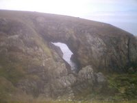
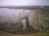
The walk then passes two natural arches, pictured, Bwa Du then Bwa Gwyn. Later we reached a part of the Path we had done before (see Walks we did Earlier (1), Rhoscolyn) but doing it in the other direction, in very different weather, made it still a new experience.
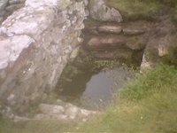
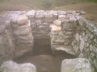
These pictures show Saint Gwenfaen's Well, one of a few ancient monuments on the Coastal Path. This is a holy well, of uncertain date but several centuries old, and said to cure mental disorders.


(Picture quality has suffered as these are phone pictures not camera pictures; camera battery ran out)

The plan was to stop for lunch at Rhoscolyn, having seen a pint of beer symbol in our coastal path map. The few houses dotted around Rhoscolyn looked rather unpromising at first, until we found The White Eagle. This place welcomes walkers, with places for sticks and ruck-sacks in the porch, is a free house with choice of beers, and the food was well above the standard you might expect for a country inn in the middle of nowhere. We would recommend this place to anybody (NB according to their website they are due to close for refurbishments next month, and the website itself has a distinct 'under construction' feel to it; best to check before you go.)

The walk carried on around the south of Holy Island towards Silver Bay before turning north. We took the seasonal route at Bodior, a curiously uninteresting diversion from the road, although after all this dry weather we were lucky that it was so dry underfoot; boardwalks over marshes were unnecessary. Lots of horseflies around here.

After reaching Four Mile Bridge, we stopped at 'Y Gegin Fach' Cafe, a very unremarkable place.

We have been doing the Coastal Path in short stretches and didn't see ourselves doing the 10-mile sections suggested by the Official Guide. But having planned this and built up to it, we've proved to ourselves we can do the longer bits - this is in fact one of those sections in the Guide. We are tired but not that tired. Perhaps we'll do another longer walk.

Saturday, July 15, 2006

Progress


Red is the path; Blue is what we've done so far.

Inland Sea


Today's walk took us along the mainland shore of the Inland Sea between Anglesey and Holy Island, on a hot, dry summer's day.

The original plan was to do Rogers Volume 2 Walk 13, but after lunch at the Valley Hotel (acceptable, nothing special), we decided to start at Four Mile Bridge instead of Cymyran. This involved walking south along the Coastal Path from the B4543 to join the Rogers walk at Tyddyn Cob. We then followed Rogers as far as the alleged cafe (of which more below), turning back then on what was his outward route.

It was close to high tide when we started. This led to some contrast in the views on the way there and back. High tide is more scenic, but there were more seabirds to be seen as the tide fell. (We also saw grouse for the first time on the Coastal Path.)

This seemed to us a much quieter part of the Coastal Path, often much less of a beaten track then we have seen elsewhere (see picture right). It was also less obviously signposted, and there were parts where we really did need the guidebook to know where to look for the line of the path.

In one respect we did find that the Rogers book (see references) needed updating. On page 73 he says, "...until you pass a small building on the right. Soon after this, bear right through a gap in the hedge/fence to join a muddy track...". We did exactly this, which essentially takes you down onto the beach. At the state of tide we encountered it was just passable - at higher tides or in stronger winds it would be more tricky. We realised later that we could have ignored going through the gap and carried on in the field higher up. In fact the Coastal Path Official Guide (same author) says at this point "bear left along a fenced track to join a muddy track...". It did seem that this was a fairly new section of Coastal Path (it's one of the permissive paths) so the "bear right" was once the best way until the new section of path was built to "bear left" onto.
Picture shows field of barley on Path


Rogers also refers to a "little cafe" although later he downgrades it to a "tea shack". It's shown as a little cup of tea symbol on the Coastal Path laminated maps, too. This being at our half-way point, it being a very warm day, and this being one of our longer walks, we eagerly looked foward to this little stop. It was closed.

Wednesday, July 12, 2006

Walks we did earlier (3)

North of Benllech

We did this sometime in the autumn of 2005, trying to follow Rogers Volume 1 Walk 3. He says "the area is well walked with excellent footpaths" and indeed it was along the Coastal Path itself - but on the inland return route, somewhere after Plas Llanfair, the path seemed to disappear. After retracing our steps, checking both the guide book and the OS map, we decided it wasn't our fault, that the path just wasn't where it was supposed to be.

Lligwy - Moelfre

We chose on Boxing Day 2005 to do this walk. We did the line of Rogers Volume 1 Walk 4 but left out Din Lligwy. The walk along the cliffs towards Moelfre was a good bracing winter walk along interesting limestone cliffs. You could see why the Royal Charter sank in that storm in 1859. This walk was not very long but enough to help walk off the effects of Christmas.

Cemlyn - Trwyn Carmel

This was a long and very bracing winter walk in late December. We started at Cemlyn, walking west along the Coastal Path as far as Carmel Head, where we went inland at the White Ladies to join the return path via Mynachdy, Hen Felin and Fronddu. (In terms of other people's walks this was Rogers Volume 1 half of Walk 8 combined with most of Walk 9, or alternatively Hamilton Circular Walks Walk 12 but cutting across at the White Ladies.)

We felt the cold when we stopped. But it was a lovely clear winter's day, and although we couldn't quite make out Ireland (which we had expected to see), there was no doubt about the outline of the Isle of Man. We didn't see a soul all the way but there was something quite dramatic about the remoteness. One of our best walks.

South of Benllech

March 2006. We started at the Wendon Cafe and followed the line of the Coastal Footpath to the corner of Red Wharf Bay, returning along the road. We stopped the Ship Inn for a pint, which was worthwhile, resolving to do this again when walking.

Beaumaris - Aberlleiniog


April 2006. We walked over the Mount at Beaumaris but after that this was a beach walk all the way; unusually for us, we returned the way we came. As at other parts of the path, there are several remains of the shipbuilding industry along this stretch, but in this case just a little more recent with the slipway of the former Laird's yard prominent along the beach.

Also of interest here are strange shaped cliffs close to Aberlleiniog where glacial drift has been eroded by the sea.

Picture shows a cave in these cliffs.

This completes the account of the walks we did after we decided to walk the whole path but before we started the blog: the blog is now up-to-date.

Saturday, July 08, 2006

Abermenai


Today we walked to Abermenai point from Llyn Rhos-ddu. We followed the route of Rogers Volume 2 Walk 15, taking the longer option, after checking the tide tables, of course. This was a longer walk than usual for us, although actually doesn't cover a great deal of the coastal path itself. As a circular walk it is probably unique in that the loop is outside the coastal path.


The walk through Newborough Warren was notable for the flora. We are used to seeing wild flowers everywhere on the coastal path, but this area, at this time of year, was exceptional.

The tidal part of the walk was easy enough, just following a straight line over the sand; and despite the tides it was still possible to see other walkers' footprints in both directions.

After walking round the point, where the strait is surprisingly narrow, followed the long trudge back along Llanddwyn beach. It was breezy, and as we got closer what had been blobs in the sky became more and more interesting as we watched the antics of kitesurfers.

As we began on the path back inland (not so well-signed as Rogers suggests) it began to rain. This was only a fine drizzle and we were prepared for it, but we were flagging a little by now and we were glad to get back.


Sunday, June 25, 2006

Red Wharf Bay

Today, 25 June, was warm but potentially showery and not too hot, so a good day for a longer walk.

Starting at the car park at the bottom of Lon y Traeth, Pentraeth, we first walked west to join up with where we had got to an earlier walk (now getting more systematic - you might say obsessive - about completing the path).

We then returned to our starting point and followed the longer option of Rogers Volume 2 Walk 2. With a falling tide, we walked eastwards along the shore line towards Llanddona beach; part of the path here is along the top of a narrrow sea wall, not altogether comfortable. The route took us back via an inland forest route passing Mynydd Llwydiarth. Here and there are views down over the bay (pictured).

The Coastal Footpath is varied in character; this was essentially a beach walk, while the inland route was different again to the cliff walks we often encounter, especially in taking us through woodland.